Overview
There is an increasing interest in spatio-temporal and network databases due to its prevalence in many applications, e.g., intelligent transportation systems, traffic analysis, etc. Real-world applications pose new research challenges for network databases, such as the combination of different types of networks, time-dependent path costs, or new types of queries. The aim of this project is to advance current query processing technologies in spatial network databases and to tackle two novel and yet unsolved problems.
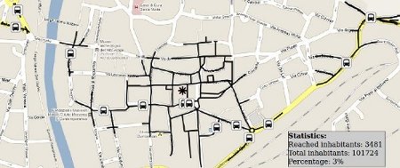
 Isochrones in multi-modal networks: An isochrone is a possibly
disconnected set of all space points from where a query point is
reachable within a given time span. Isochrones can be used to answer
reachability queries in various application domains, e.g., to
determine the geographic scope of a local market or to assess how well
a city is covered by public services such as hospitals or schools. By
joining an isochrone with the inhabitants database, the percentage of
citizens living in the isochrone area can be determined. For
instance, how many kids can reach a school or kindergarten in 15
minutes time?
We define isochrones for multi-modal networks, where the use of cars is considered in addition to walking and public transportation, and we provide efficient and scalable algorithmic solutions for the computation of isochrones in such networks. We will also study a number of new application scenarios, such as the reachability analysis of bus stops or the coverage of a region for evacuation and civil defense. [more >>]
 Sequenced spatio-temporal aggregation in road networks: The
proliferation of Global Positioning System (GPS) technology
facilitates the tracking of car positions. Cars that are equipped
with a GPS receiver periodically send their position to a central
server. In such an application scenario, sequenced spatio-temporal
aggregation (SSTA) can be used to obtain a summary of the traffic
density in a city. Conceptually, SSTA produces one aggregate value
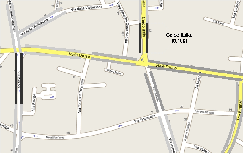
for each query point in space and time. The figure illustrates the
result of an SSTA query, where the lines in different shades of gray
along road segments indicate the density of the traffic on that
segment, varying from very low traffic (no line) to moderate traffic
(gray line) and jammed traffic (black line).
We investigate sequenced spatio-temporal aggregation for the SUM, COUNT, AVG, MIN, and MAX aggregate functions, and we develop efficient algorithmic solutions. To obtain a more concise result relation, we adopt a parsimonious aggregation strategy, where (temporally and spatially) adjacent tuples are merged if their aggregation values are similar, yielding a data-driven approach to control the result size.
